

Property owners, builders, and developers planning a project close to a civil airport often ask one question first: how tall can I build? The honest answer is that there is no single fixed number. Maximum building height near airports in India depends on the specific airport, the direction and distance of the plot from the runway, and the type of obstacle limitation surface that applies to that location. This guide explains how these limits are determined, who regulates them, and what builders and property owners need to do before finalising a design.
Table of Contents
Why Building Height Near Airports Is Regulated
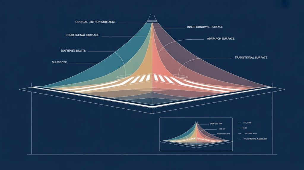
Aircraft rely on clear, predictable airspace during take-off, landing, and low-altitude manoeuvring. Any tall structure, whether a residential tower, a telecom mast, a chimney, or a construction crane, can interfere with flight paths, radar coverage, or navigation aids if it intrudes into protected airspace. To prevent this, civil aviation regulators define invisible three-dimensional surfaces around every airport, and construction within these surfaces is restricted or prohibited depending on how close it comes to the flight path.
In India, this regulation is governed primarily by the Ministry of Civil Aviation Height Restrictions for Safeguarding of Aircraft Operations Rules, 2015, issued under the Aircraft Act. These rules apply airport zone height restrictions to any structure within 20 kilometres of an aerodrome reference point, and in some cases up to 56 kilometres depending on the facility involved.
How Maximum Building Height Near Airports in India Is Determined
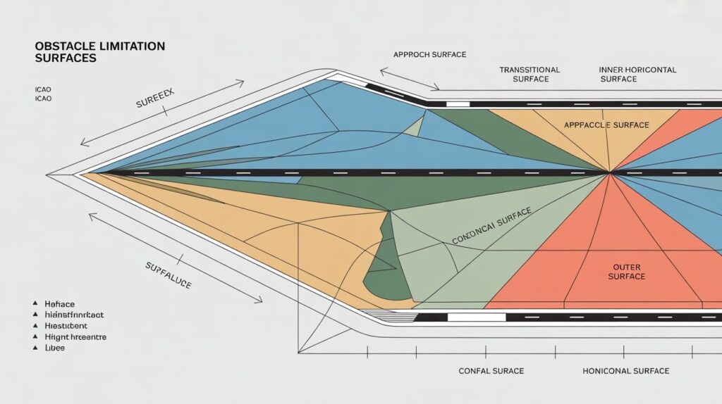
There is no uniform height cap that applies across the country. Maximum building height near airports in India is calculated case by case using a set of internationally recognised reference planes known as Obstacle Limitation Surfaces, or OLS, defined under ICAO Annex 14 and adopted into Indian regulation.
The main OLS categories include the approach and take-off climb surfaces, which slope upward from each end of the runway along the flight path, the transitional surface, which rises from the sides of the runway strip, the inner horizontal surface, which forms a flat plane at a set elevation above the aerodrome, and the conical surface, which slopes upward and outward from the edge of the inner horizontal surface. A plot located within the approach or take-off surface will typically face a much lower permissible height than a plot further out under the conical or outer horizontal surface.
A second factor that trips up many first-time applicants is the difference between height above ground level, or AGL, and height above mean sea level, or AMSL. AAI evaluates permissible height in AMSL terms, meaning your building height must be added to your plot’s ground elevation and compared against the maximum AMSL value permitted at that specific coordinate. Two plots with an identical ground-level height limit can therefore have very different construction allowances once their site elevation is factored in.
To make this system easier to navigate, AAI also issues Colour-Coded Zoning Maps, known as CCZM, for the area around each airport. These maps divide the surrounding land into colour-coded grids, each carrying a maximum permissible height. Builders can use the CCZM as a starting reference, though the final permissible figure for a specific project should always be confirmed through the formal application process rather than read off a map alone.
It is also worth noting that CCZMs and OLS calculations are periodically revised when an airport upgrades its runway, adds new navigation equipment, or changes its operational category. A zoning map that was accurate for a neighbouring project two years ago may not reflect the current permissible height for your plot today, which is another reason generic figures circulating online should be treated with caution rather than relied upon directly.
Role of AAI and Height Clearance

The Airports Authority of India is the designated authority responsible for evaluating and issuing height clearance for civil aerodromes, while defence authorities perform a similar role near military airbases. AAI height limit rules require that any construction proposal within the notified radius of an airport be submitted through the NOC Application System, known as NOCAS, along with surveyed site coordinates in the WGS-84 format and the site’s elevation.
Once an application is filed, AAI checks the proposed height against the applicable OLS category, taking into account instrument flight procedures and communication, navigation, and surveillance requirements at that airport. Based on this assessment, AAI may grant the NOC for the height requested, grant it for a lower height than requested, or raise an objection where the structure would pose a genuine safety risk. Importantly, in colour-coded zones where the proposed height falls below the prescribed threshold, some approvals can be handled directly by local municipal authorities rather than requiring AAI’s direct clearance, though this depends entirely on the applicable zone classification for that plot.
Factors Affecting Permissible Building Height
Several variables combine to determine the height clearance limits India applies to a given plot, which is why generic height figures found online should never be used for actual project planning.
- Distance and direction from the runway centreline and threshold, since plots directly under an approach or take-off path face stricter limits than plots to the side.
- Ground elevation of the site relative to mean sea level, since AAI evaluates AMSL rather than raw building height.
- The specific OLS category applicable to that coordinate, which can change over a relatively short distance.
- The presence of navigation aids, radar installations, or communication equipment near the site, which may impose additional restrictions beyond standard OLS criteria.
- Whether the airport is a civil aerodrome, a defence airbase, or a joint-use facility, since defence-controlled zones can carry separate restrictions under the Works of Defence Act in addition to aviation height rules.
- Any temporary notified restrictions, such as those linked to a new runway, a navigation aid upgrade, or an ongoing airport expansion.
Because these factors interact, permissible building height near airport locations can vary meaningfully between two plots that appear similar on a map. A site-specific application is the only reliable way to confirm an actual number.
How to Obtain Height Clearance/NOC
Builders and property owners typically follow this sequence when seeking height clearance for a project near an airport.
- Confirm whether the proposed site falls within the notified radius of any civil or defence airport using the applicable zoning map.
- Commission a professional survey to establish accurate WGS-84 coordinates and site elevation, since incorrect data is one of the most common causes of application delay.
- Register on the NOCAS portal and file the application with supporting documents, including ownership proof and any required recommendation from the local planning authority.
- Track the application status online and respond promptly to any deficiency remarks raised by the reviewing office.
- Once the NOC is issued, submit it along with the building plan to the local municipal or development authority, since final construction sanction still requires their approval in addition to AAI clearance.
Given the technical detail involved in coordinate surveys and OLS interpretation, many developers choose to work with an aviation height clearance consultant in India rather than navigating the process independently, particularly for large or phased projects where even a small height miscalculation can affect multiple structures.
What Happens If Height Limits Are Exceeded?

Constructing beyond the permitted height without clearance carries serious consequences. Local authorities can refuse occupancy or completion certificates for structures that do not have a valid AAI NOC, and in some cases, unauthorised construction can be ordered to be reduced in height or demolished. Beyond regulatory risk, structures that breach OLS criteria pose a genuine safety concern for aircraft operations, which is the underlying reason these rules exist in the first place.
Developers should also be cautious about starting construction based on a preliminary status update or an informal estimate of permissible height. Only a formally issued NOC, specifying the approved height and any conditions attached to it, should be treated as the final basis for construction near an airport. Retrofitting a structure to reduce its height after construction is far costlier than confirming the correct limit at the design stage, and in some cases structural changes of this scale are not practically feasible once a building is complete.
A general note on scope: the information in this guide explains how height restrictions work in principle and the regulatory framework that governs them. It is not a substitute for project-specific regulatory advice. The actual permissible height for any given plot depends on data that only a formal AAI application can confirm, including exact WGS-84 coordinates, verified site elevation, and the current zoning classification for that airport. Treat published guides, including this one, as a starting point for understanding the process rather than a source for a final construction figure.
Not Sure What Height Your Project Can Reach?
Complyn Advisory Services helps builders and developers across India confirm site-specific height clearance and file AAI NOC applications correctly the first time.
Common Questions About Maximum Building Height Near Airports in India (FAQS)
Is there a single maximum height that applies to all airports in India?
No. Maximum building height near airports in India is determined individually for each site based on distance from the runway, applicable OLS category, and ground elevation.
What are AAI height limit rules based on?
They are based on the Height Restrictions for Safeguarding of Aircraft Operations Rules, 2015, and the ICAO Annex 14 Obstacle Limitation Surfaces adopted into Indian regulation.
How far from an airport do height restrictions apply?
Airport zone height restrictions generally apply within 20 kilometres of the aerodrome reference point, extending further in specific cases involving navigation facilities.
Do I need an AAI NOC even if my building is well below the height restriction?
In many colour-coded zones, low-height structures can be approved by local authorities directly, but this depends on the specific zone classification, so confirmation is still recommended.
What is the difference between AGL and AMSL in height clearance?
AGL measures height from the ground, while AMSL measures elevation above mean sea level. AAI evaluates applications in AMSL terms, combining building height with site elevation.
Can height clearance limits India change after a project is approved elsewhere nearby?
Yes, in some cases new navigation infrastructure or airport expansion can lead to revised restrictions for surrounding zones, which is why current confirmation matters even for familiar locations.
Who can help determine the permissible building height near airport sites?
A qualified surveyor combined with an aviation height clearance consultant in India can help establish accurate coordinates and interpret the applicable OLS category before a formal application is filed.
What happens if my building already exceeds the permitted height?
The matter should be addressed promptly with the relevant authority, since unresolved violations can affect occupancy certification and, in serious cases, lead to enforcement action.
Conclusion
There is no shortcut to a single number when it comes to maximum building height near airports in India. The permissible height for any project depends on its exact coordinates, its elevation above sea level, and the specific obstacle limitation surface that applies at that location, all of which must be verified through the formal AAI process rather than assumed from a nearby project or a general online estimate. Complyn Advisory Services works with builders, architects, and developers across India on AAI NOC applications, coordinate verification, and height clearance documentation, helping avoid the common errors that lead to delays or rejected applications.
For guidance specific to your project, read more on our detailed breakdown of the AAI NOC process, or reach out to Complyn Advisory Services directly to confirm the applicable height restrictions for your site before finalising your design.